Standard Toolbox

The Toolbox groups common tools in a horizontal tabbed strip along the top of the map. This provides quick and convenient access to commonly performed operations. In The National Map Viewer, the toolbox is divided into three tabs:
The active tool is specified to the right of the toolbox tabs, and indicates the tool that is currently being used to interact with the map.
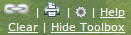
The display of the Toolbox panel can be toggled on and off by clicking the Hide/Show Toolbox link at the upper right corner of the viewer.
The Standard toolbox consists of the following tools:
| Map Navigation - pan the map display. | |
| Identify - view attribute information for features. | |
| Find Coordinates - find the coordinates of a particular location. | |
| Clear Graphics - remove annotations on the map. | |
| Reset Zoom (Initial Extent) - reset the zoom to it's initial extent. | |
| Zoom to Last Extent - zoom to the last known extent. | |
| Zoom in Box - zoom by a user-defined box. | |
| Spot Elevation - returns the elevation of a given location. | |
| Download Data - links to the new TNM Download Client. |

| Measure Distance - measure a distance between two points or more on the map display. | |
| Measure Area - measure an area on the map display. | |
| Search CSW - search and add Catalog Search Web (CSW) data to the map. | |
| Query Builder - build and run a query on layer features. | |
| Filter Manager - view, delete, save, and load filters. | |
| Selection Manager - work with features that are selected on the map display. | |
| Select With Buffered Point - create a buffer around a point and selects user-specified features contained within that buffered region. | |
| Buffer By Selection - create a buffer around selected features on the map display. | |
| Range Ring - create a range ring from a user-specified point on the map display. |

| Add Point - add a point to the map. | |
| Draw Line - add a line on the map. | |
| Draw Polygon - add a polygon on the map. | |
| Draw Text - add text to the map. | |
| Draw Rectangle - add a rectangle to the map | |
| Draw Ellipse - add an ellipse to the map. | |
| Draw Bound Ellipse - add a bound ellipse to the map. | |
| Delete Annotations - delete all the annotation on one or more layers. | |
| Export Annotations - export the current map annotations as a zip file as a Shapefile or KML. | |
| Export NED Points - export the current NED-based spot elevations as CSV formatted text. |